reflection of a person holding an umbrella

Water Has Its Ways

Tulane experts address how to live with threats of flooding in the urban environment through safe, equitable and sustainable ways.

(Photography by Paula Burch-Celentano)

When cities face extreme weather brought on by climate change, finding the right solution can be as unpredictable as the rainfall. The complex relationships between government, geography, the built environment and community members are unique to regions. But Tulane faculty approach water management in new ways, upending old thinking about how to deal with it and how it affects communities.

Margarita Jover, Jesse Keenan and Joshua Lewis, each with their own expertise on water and climate-related issues in urban environments, know well the peril and promise of the world’s most plentiful resource. The trio recently shared their insights on how our relationship with water is changing and ways in which we can — and already are — adapting.

“Environmental change is not new in coastal Louisiana. That’s an inherent aspect of this place. It is constantly changing, shifting; it’s al ways growing; it’s always degrading,” said Joshua Lewis, research associate professor and research director at the Tulane ByWater Institute.

And with those changes, we need to adapt, or as Lewis describes it: “We need to live in the rhythms of Louisiana.”

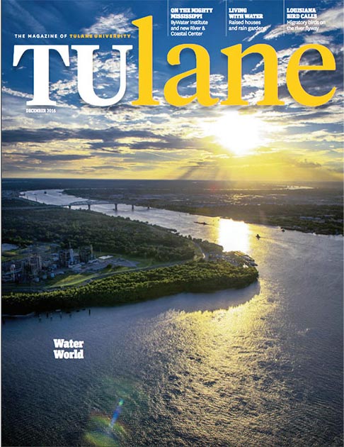
New Orleans might experience three types of flooding: riverine from the Mississippi River, precipitation-induced from a rainstorm or hurricane, and storm surge.

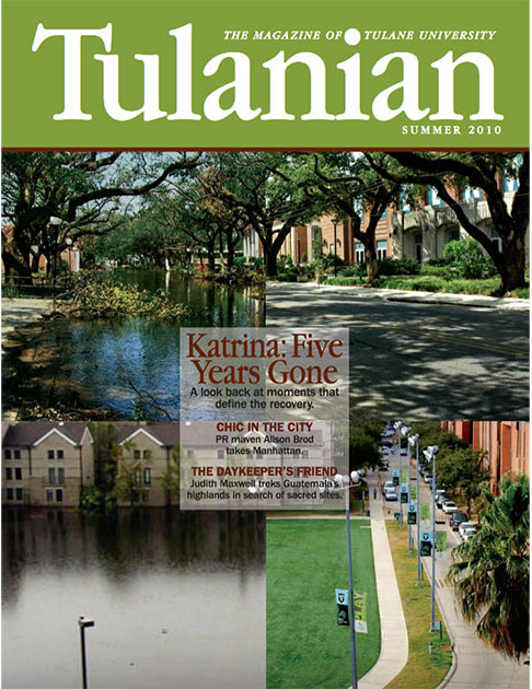
All are concerning on their own but what is more concerning is when these types combine with one another. Hurricane Katrina brought storm surge flooding to the city, and since then, the levees, gates and storm surge barriers have been improved. Now, though, there is more to consider.

“What we don’t know is what happens if the river flooding season lasts longer and it starts to overlap with hurricane season. And then we get a big storm surge event at the same time as we get river flooding,” Lewis said.

Hurricane Barry, a Category 1 hurricane that made landfall in Louisiana in July 2019, is an example of a hurricane occurring when Mississippi River levels had been elevated for a prolonged period. Barry, with 75-mile-per-hour winds at its strongest, dropped heavy rainfall. But the Mississippi River levees easily held as they are designed to do.

Precipitation-induced street flooding, even without a hurricane, is the type of flooding New Orleanians are accustomed to seeing — especially lately.

“That alone has emerged as the most day-to-day regular type of event — with its increased frequency and intensity — that we’re not really equipped to deal with,” Lewis said.

Historically, the city has used canals and pumps to get water out of the city as quickly as possible. However, Lewis said there are limitations with that type of drainage system.

“We understand that it causes the land to subside. As you continually pump out all this water, and you drain swampy areas, you get subsidence and compaction, and that’s what creates this below-sea-level situation.

“That’s the big issue. That it’s too much water too fast,” he said.

Following the unprecedented 2020 hurricane season, in which five named storms made landfall in Louisiana, breaking the state record for a single season, and with other more frequent severe weather events expected, Lewis is looking to manage water in new ways.

Portrait of Josh Lewis, research director at ByWater Institute
Josh Lewis surveys Mirabeau Garden, part of the Gentilly Resilience District.

Lewis said a more effective solution may be to hold on to the water, so it doesn’t easily inundate the city’s current infrastructure.

“Now we’re trying to figure out, ‘OK, how can we create temporary reservoirs within that system to hold water?’ I think that holds a lot of promise if this was able to be implemented citywide. That’s millions of gallons of stormwater that wouldn’t immediately overwhelm the system.”

Lewis leads an ecological monitoring program funded by the City of New Orleans and the U.S. Department of Housing and Urban Development. His research examines the ecological impacts of new water techniques. The program is part of a bigger project called the Gentilly Resilience District, a neighborhood-scale green infrastructure project designed to intercept and detain stormwater during major rain/weather events.

Part of the infrastructure project is the Pontilly Neighborhood Stormwater Network. This project includes the addition of bioswales and other interventions along streets and vacant lots to capture stormwater, reduce flooding and improve drainage, while beautifying the Gentilly Woods and Pontchartrain Park neighborhoods.

Another substantial part of the Gentilly Resilience District is the Mirabeau Water Garden. Located off Mirabeau Avenue between Bayou St. John and the London Avenue Canal, this project aims to transform 25 acres to temporarily store stormwater in a retention basin while also serving as a recreational and educational tool for the public. It will feature green spaces and parklike landscaping.

Lewis is upbeat about the project: “It’s large in scale. It’s likely to make a difference in flooding. And it’s publicly accessible for people to go visit and see how it works.”

He is hopeful the project will become a point of pride for the neighborhood and a national standard for similar projects. 

“As we make these major shifts in water management, we need to keep an eye on how they may impact mosquito populations, birdlife, rodents and so on,” said Lewis. “Ecosystems can help us manage flooding, but also tend to have a mind of their own. Maintenance, adaptive management and neighborhood participation are all keys for the long-term success of these projects.”

Portrait of Margarita Jover, associate professor of architecture
Margarita Jover visits Crescent Park, an urban linear public space on the Mississippi River waterfront. The Piety Street footbridge is in the background.

Water as an Ally

Margarita Jover, associate professor of architecture, embraces the use of water.

“Instead of thinking under the previous paradigm of control and domination typical of the 20th century, we can work with water in a collaborative manner,” Jover said.

Jover co-founded the internationally award-winning architecture and landscape firm aldayjover in Barcelona, Spain, with her spouse, Tulane School of Architecture Dean Iñaki Alday. The firm has been recognized for its projects that build a new relationship between cities and rivers.

Jover said that treating water as an ally can provide opportunities for gaining biodiversity, better microclimates, lessening pollution, increasing groundwater infiltration and more urban resilience for coping with climate change. She is a firm believer that working with water in urbanized contexts can provide collaborations across disciplines and people.

Jover teaches a research studio at the School of Architecture that centers around the future of urban ports, including looking at the New Orleans Industrial Canal. She also teaches a core studio on collective housing. In both cases, she engages the cycle of water.

“With the students in the collective housing studio, we think about ‘urbanism by cooperation’ and how to densify from the ground up at the scale of the urban block in New Orleans. Densification and mixture of incomes and uses are tested on different sites to liberate land to store water in the site, and to cultivate food or generate collective space for social life outside commercial environments,” Jover said. “These types of projects can inspire new policies that can activate not only new economies but also more resilience to climate change. It can make a significant difference to redevelop the city in this direction.”

Portrait of Jesse M. Keenan, associate professor of real estate at the School of Architecture
Jesse M. Keenan stands next to the Mississippi River near the French Quarter with the New Orleans downtown skyline behind him.

Banks Are Noticing

As residents in Louisiana and across the nation are adapting to climate change and more frequent extreme weather events, so too are banks and lenders.

Jesse M. Keenan, associate professor of real estate at the School of Architecture, said markets are gaining a better understanding of which areas are at greater risk and vulnerability due to climate change. As a result, banks or lenders are what Keenan calls “blue-lining,” which is the process by which maps or lines are drawn around areas considered high-risk investments.

Keenan noted that he used the color blue to indicate water because he initially noticed in his research that this process was associated with areas specific to sea-level rise and flooding. But “blue-lining” can be applied to areas of increased risk of forest fires and maybe even, one day, of extreme heat.

“When they draw these maps, they’re saying, ‘OK, this is a high-risk area, and we want to manage our risk in that area.’ It doesn’t always mean that they’re not going to invest there, but it means that they’re going to manage those risks in different ways,” Keenan said.

Examples of managing those risks include charging higher interest rates on loans, offering smaller loans over shorter periods of time, or avoiding the area altogether.

However, Keenan said, there is a lot of arbitrariness in the drawing of these climate risk maps. Sometimes they are not even maps, but rather a collection of ZIP codes or census tracts, which obscures the geography of the risks.

“Some people are inside the zone who may not necessarily be at risk, and then there’s some people who really are at risk, but they’re not necessarily in the inside of this zone of risk,” he said. 

The process carries a lack of transparency, and it is also a social equity issue as it overlaps with the institutionalized discriminatory practice of “redlining.” (Redlining was historically used to deny financial services or loans to certain communities, mainly minority communities.)

The redlining practice left behind levels of disinvestment in infrastructure in certain areas where increases in climate-attributed events, like extreme precipitation, can’t be easily managed.

“This is extremely problematic, because now you’re talking about people who have low-to-moderate incomes, or have been historically marginalized, now feeling the extra burden of climate change being amplified,” Keenan said.

From an individual consumer or homebuyer standpoint, Keenan said there are public resources that can be utilized to determine if one may be in a high-risk area. The National Oceanic and Atmospheric Administration Sea Level Rise and Coastal Impacts Viewer (coast.noaa.gov/slr) allows users to see projected rates over time of sea-level rise, marsh migration and high-tide flooding. Keenan also suggests using the U.S. Climate Resilience Toolkit (toolkit.climate.gov). (He’s the editor of the Built Environment section.) This tool shows projections of what communities may look like in the future with climate change.

Keenan pointed out that these resources are meant to offer insight, but some users may overact to their own perceived risk.

“Some of this stuff is very complicated, and sometimes when you simplify it to a website or something like that, people misinterpret the risk,” he said. “So, the challenge is, how can we take this supersophisticated science and distill it in a way that it can be accessible to people and it can be communicated with a certain confidence interval?”

Planning for the Future

With climate change–related weather events continuing to occur and by no means slowing down, what can be done for the future?

Jover, the urban planner and landscape architect, said, “We need to feed the public discourse with alternative city models holding alternative values, and these alternative city models need to be democratically discussed.”

There are many possible alternative futures for cities, said Jover. And these futures can be better than the present we have now. “We are too conformist in thinking that the market and private-driven interests alone are the only mechanisms to develop cities,” she said. “But this is not true, especially when facing socioecological challenges.

“Long-term plans at the metropolitan scale are urgently needed to act as catalysts or platforms for common agreement.”

These plans should address “an equal distribution of wealth and opportunity,” said Jover. Residents often become defensive when new plans, particularly “master plans,” are announced. The plans are perceived as being developed by private investors for their own profit. The way to get around this mistrust, according to Jover, is to create plans that are for the “greater good” and discuss them openly in the public sphere.

Plans may indicate the densification of a city in some places, “but not in a way that is done by the market only,” said Jover — instead, “in a way with the residents on site.”

This is a formula for “urbanism by cooperation,” which means people living in a specific neighborhood can redevelop and densify and then reap economic benefit from the redevelopment.

“When residents become wealthier and have more economic opportunities, the neighborhood can become more sustainable, liberating land for water storage,” she added.

Keenan, the real estate expert, said that to cope with climate change, cities will have to concentrate and invest in infrastructure in areas that are defensible or low-risk for the long term and, at the same time, be mindful to provide inclusionary, mixed-income housing for residents who may get pushed out of those areas in the process.

In addition to being a Tulane faculty member, Keenan recently joined the Biden Administration as a senior economist with the U.S. Department of Defense to co-lead a research team working on climate change, resilience and infrastructure across the federal government. He was also appointed to a committee of the National Academies of the Sciences, Engineering and Medicine to guide the investment of the BP endowment for research investments that support community resilience in Gulf Coast communities.

Focused on New Orleans, Lewis said that in addition to living with the rhythms of the state, the city needs to keep an open mind, try new methods and keep going. He has noticed a “public-spiritedness” following both Hurricane Katrina and during the COVID-19 pandemic when residents adapted to new restrictions and looked out for one another. And the same can be said for adapting to our relationship with water.

“Keeping New Orleans above water is a collective project,” said Lewis. “We’re going to have to take care of each other in the big ways through investments in our infrastructure and continue to take care of each other in smaller, everyday ways in our neighborhoods because there are big changes on the horizon.”

Tags